 |
Hazen's Notch Trails
Hiking, Nordic Skiing and Snowshoeing
Trails open to hiking May 9 - Nov 13, 2026.
Trails are CLOSED during rifle portion of deer hunting season Nov 14-29, 2026.
Trails open to xc skiing and snowshoeing Dec 15, 2025 - April 1, 2026.
Three Nature Preserves in Montgomery, Vermont
- High Ponds Farm Nature Preserve
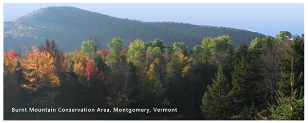
478 Rossier Rd., Montgomery VT External web site 🡕 - Burnt Mountain Conservation Area
478 Rossier Rd., Montgomery, VT External web site 🡕 - Bear Paw Pond Conservation Area
1000 Hazen's Notch Rd., Montgomery, VT External web site 🡕
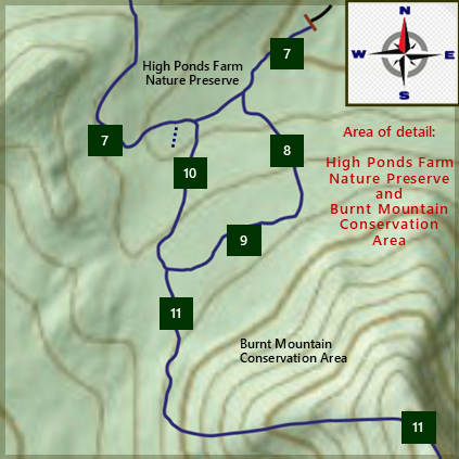
Trail Maps and Suggested Routes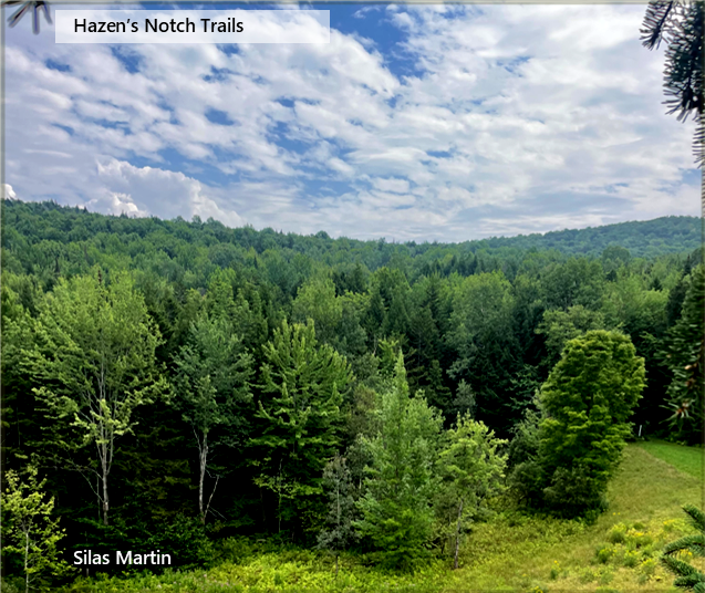 from Coyote Meadow Database List of Hazen's Notch Trails - Montgomery, Vermont Links to new, 2024 updated detailed area maps for (1 & 2) Bear Paw Pond Area and (3 & 4) High Ponds Farm and Burnt Mountain Area are in the next two sections on this page. Hazen's Notch Trail Map 2024 USGS and Vermont GIS Map of Hazen's Notch Trails is Incorrect |
 Bear Paw Pond Conservation Area
High Ponds Farm, Moosewood Ponds, High Meadow, Burnt Mountain
|
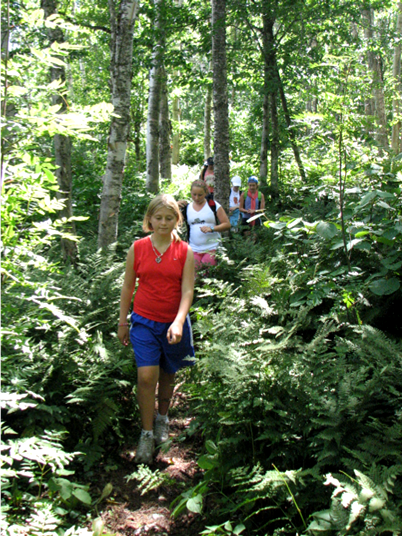
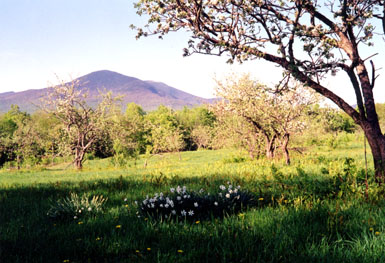
Hiking Trails Spring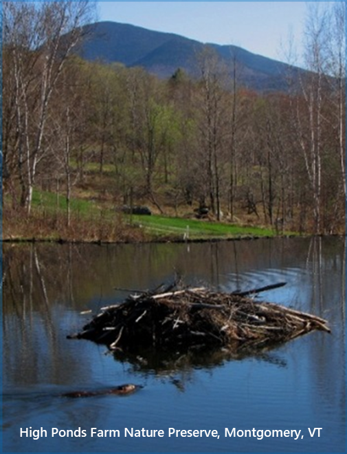 Trails are closed during Spring Mud Season. Starting in the third week of April, walkers may enjoy the flowers and song birds. At the High Ponds Farm do not walk past the High Meadow. At the Bear Paw Pond Area, do not walk past the Coyote Meadow. The trail to the summit of Burnt Mountain will open in mid May. Thank you for your cooperation. Summer + FallHazen's Notch Trails
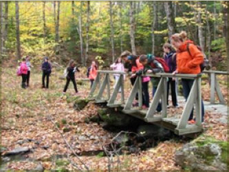
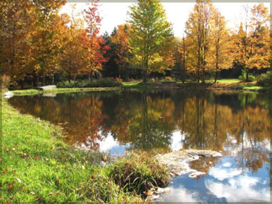
Cross Country Skiing + Snowshoeing Dec 15, 2025 - April 1, 2026 Mud Season April 2 - May 8, 2026 (Trails Closed) Hiking + Walking May 9 - Nov 13, 2026 Nov 31 - 5, 2026 Hunting Nov 14 - Nov 29, 2026 (Trails Closed) Dec 5 - 13, 2026 (Trails Closed) The Hazen's Notch Association maintains a network of 15 miles of trails and woods roads for hiking in Summer and Fall. These are part of a larger network of 24 miles of trails that are maintained in Winter for cross-country skiing and snowshoeing in the Hazen's Notch/Jay Peak area of northern Vermont. The trails pass through a variety of interesting habitats that include meadows, forests, orchards, and beaver ponds. Trails range from restored woods roads that have gentle to moderate grades to narrow footpaths with steep climbs. There are numerous splendid views of the Jay Mountains in addition to the incredible beauty of the wildlfowers and wildlife that one sees along the trails. Pack a lunch and water as you will find several picnic tables at popular destinations such as the Moosewood Ponds, the High Meadow, Little Rock Pond and Bear Paw Pond. Bring a camera and/or binoculars. Most of the photographs on this website were taken while walking, skiing and snowshoeing on the Hazen's Notch Association trails. |
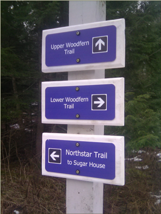
 TRAIL UPDATES: At the High Ponds Farm on the Rossier Road, trail users pass a small beaver pond on the right. At the next trail intersection, the trail to the left has been renamed "Dodge Trail" after John Dodge. The Dodge Trail crosses over Flood Brook on a refurbished bridge (August 2022) and ascends to the junction with the Notch Trail. Turning right and going in a westerly direction on the Notch Trail, trail users traverse the base of Burnt Mountain, passing over a new bridge (August 10, 2021), and come to the junction with the Sunset Ridge Trail. Continuing straight on the Notch Trail, the upper corner of the High Meadow comes into view. From here trail users can descend via the High Meadow Trail to the Moosewood Ponds and the entrance to the High Ponds Farm. This 1.5-mile loop is described in the one-page PDF file "Suggested Routes". See the
Reviews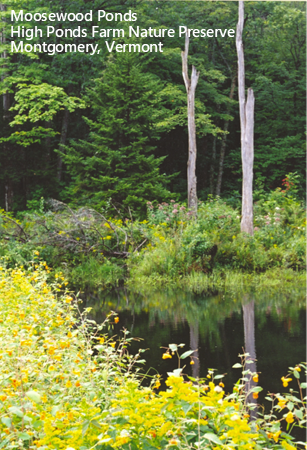 Zen-like hike in a pristine refuge. It feels like you are a million miles away from civilization. Mr. Arturo, May 27, 2012 |
Suggested Routes |
Rules for Use of Area / Trails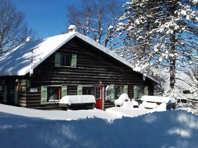 Hazen's Notch Trails Map 2024.pdf Please observe all trail and area use rules. They are posted at the trail access parking areas and on signs along the trails. Fires, camping, motorized vehicles, swimming and fishing are not allowed. Dogs must be on a short leash at all times. In addition to minimizing conflicts between other people and their dogs, the leash rule is intended to prevent dogs from harassing wildlife which use the trails and adjoining areas as travel and feeding corridors as well as sites for raising their young. Note that retractable "flexi-leads" are inadequate for controlling your dog. With 12 to 15 feet of lead, a dog can catch and kill a small animal before the owner even realizes that their dog is doing more than sniffing in the vegetation along the trails. Hermit thrush, for example, will regularly nest as few as 12" above the ground and within a few feet of the edge of a well-travelled trail. Fledgling grouse, as yet unable to fly more than 3 feet high or more than a distance of 12 feet, can be easy prey for a dog. Hikers who do not observe the HNA dog leash rule will be asked to leave. For a complete list of rules, please see Visitor Information Important Information about Access to Trails 
Please be aware that all HNA trails, parking areas, access roads, and all adjacent lands are private property. Access is at the discretion of the Hazen's Notch Association and the respective landowners. The trails and parking areas are open during daylight hours only. Do not drive past any gates even if left open. Gates that are open are open for the convenience of the private landowner and are not an invitation to drive beyond the gate.  Group Visits:Please note that while the HNA Trails are open to the public at no charge, a fee is charged for groups. This includes school, home school, church or other community groups. This includes both non-profit and for-profit groups and whether your visit is self-directed or facilitated by HNA staff. There are many costs associated with the management of trails that are open to the public. Group use fees and membership contributions help the HNA to meet these expenses. Please contact the HNA to arrange your group visit. Thank you.  Visitor Information:For complete area use rules, see Visitor Information. |
Winter
Skiers + Snowshoers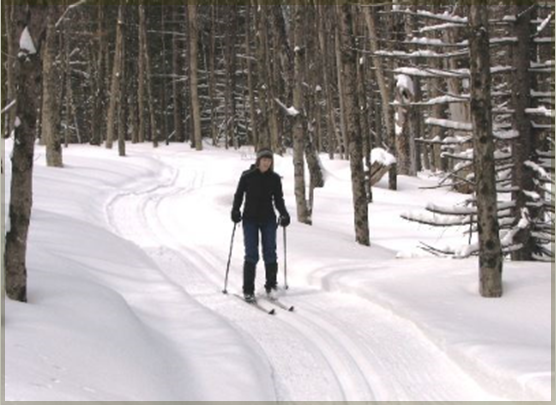
Bear Paw Pond Conservation Area
The trails are open in winter from December 15, 2025 to March 31, 2026, after which they are closed during Spring Mud Season. There is no charge to use the Hazen's Notch trails. Donations are welcome. The Welcome Center is only occasionally open. Winter access to Hazen's Notch trails is limited to the Welcome Center parking area and the Bear Paw Pond area parking. The High Ponds Farm access is closed to parking during snow storms so that the Town and private snowplowing trucks may pass. In Winter dogs are prohibited from all areas within the trail network.
15 trails provide loops of different lengths for cross-country skiing and/or snowshoeing. Trail difficulty is evenly divided between easy, moderate and difficult. As the trails are not groomed, skiers should choose to use wider, backcountry skis if possible.
More Information on hazensnotch.orgToday was another spectacular day at Hazen's Notch. The sun coming through the trees creating an enchantment in the forest. It's cold - but with the exertion of the skiing it's refreshingly so. Over the years we've seen many things - rabbits, hawks, deer, foxes, squirrels, ruffed grouse. It's one of the reasons I ski alone - I love the quiet. My favorite trail - Dark Entry, over to the Beaver Ponds and then up to the High Meadow gives me a spiritual feeling of being at peace with the world. Your trails are special. They are cut in a way which respects nature, respects the environment and creates a special place for us all to enjoy. Thank you. Bob Bonnell |